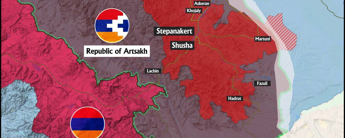
Overview of the Karabakh control lines + Map of Karabakh
In seventh century, a triangle area between river’s Kura, Aras and Zengezur mountain was called Karabakh. Terrain of the area is rich and includes prairies and high mountains. Near end of 18th century, local lord of the Karabakh was the most powerful lord among Caucasus lords but due to rampant diseases, many died or migrated, … Continue reading Overview of the Karabakh control lines + Map of Karabakh
0 Comments