Satellite Images Of Clashes Between Palestinian Resistance, Israeli Army In Gaza
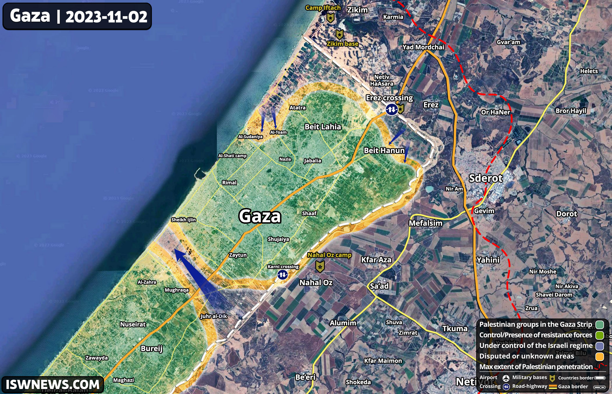
The satellite images indicate the Israeli army’s advancement in the central front of the Gaza Strip. Some mechanized infantries have reached the coastal road as heavy fighting continue in an area in the southeast of Gaza City.
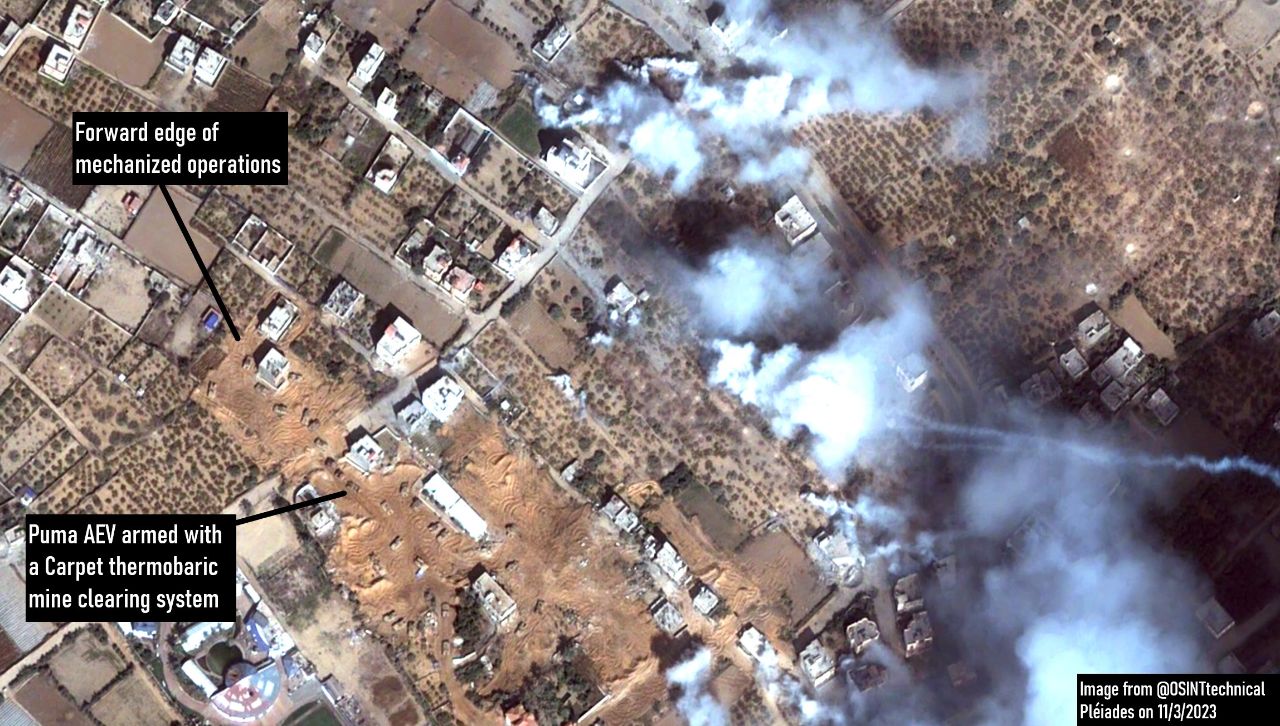
It seems that the Israeli army’s strategy in this area is to first clear the routes of any mines or bombs planted by Palestinian resistance with D-9 bulldozers, and then advance tanks and military vehicles towards the Mediterranean coast.
Additionally, every half-mile, a large circular earthwork is built as a stronghold for tanks and armored vehicles.

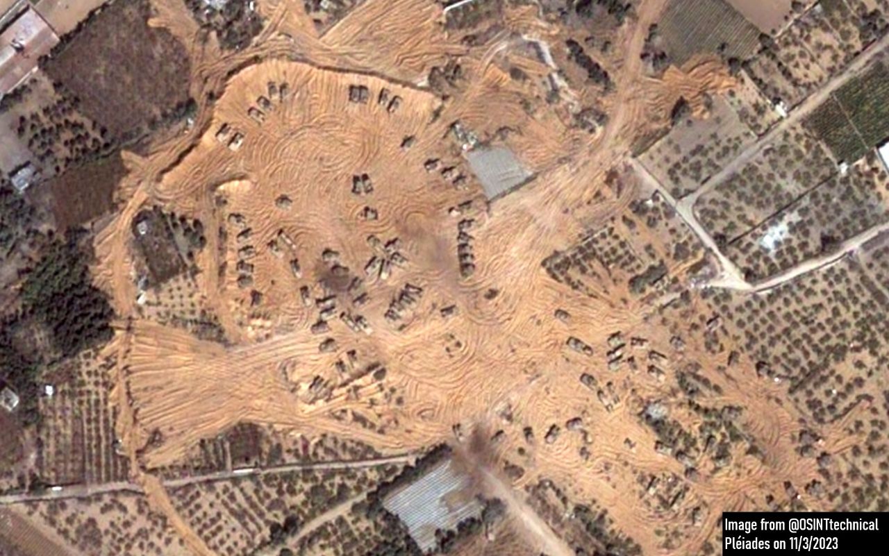
The satellite images also show the Israeli army’s advancement with D-9 bulldozers and armored vehicles towards the coast, as well as the location of the recent massacre of several Palestinian civilians by Israeli soldiers on Al-Rashid Street.
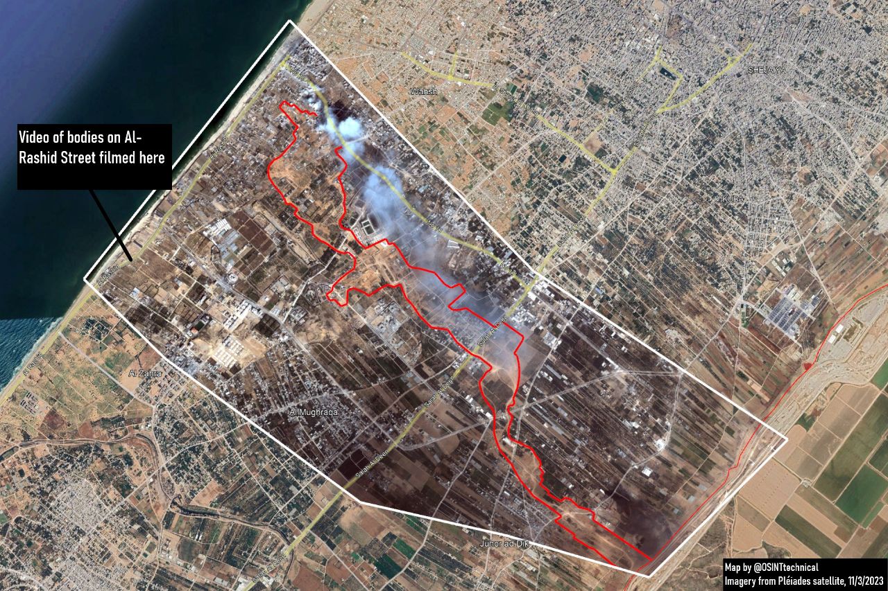
Overall, Israel’s movement in the central front of Gaza is fragile, and Palestinian resistance can not only launch hit-and-run attacks but also launch a heavy counter-attack from the southern axis of Juhar al-Dik and southern Al-Zaytoun district to besiege Israeli forces in the southeast of Gaza City.
However, this counter-attack requires sufficient forces and weapons, readiness to withstand heavy airstrikes, and diverting the attention of the Israeli army to other fronts, especially the Lebanese front.
Therefore, joint operations with Lebanon’s Hezbollah as well as missile and drone attacks by resistance groups in Iraq and Yemen can pave the way for the implementation of the resistance’s counter-attack in the central and northern fronts of Gaza.



Comment