Map: Damascus-Aleppo Highway Completely Secured!

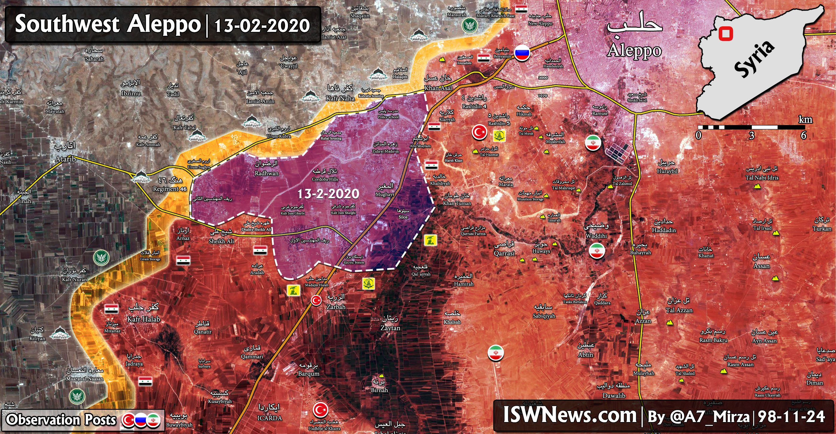
ISWNews Analysis Group: Following the Syrian Army and Resistance Forces operation in the Aleppo province, the Aleppo-Damascus highway along with a number of important and strategic areas west of the M5 were cleared from the presence of Tahrir al-Sham terrorists.
The liberated areas include Zahrat al-Madaen, the Khan Tuman silos and the surrounding farms, Rif al-Muhandisin 1 and 2, al-Mughair, western and eastern Kafrjum, al-Rahal housing and parts of Kahraba housing.
According to the latest information from our sources in southwest Aleppo, clashes continue between the Army/Resistance forces and terrorists in Orum al-Soghra and Kobra, Kahraba housing, Kafr Naha and Halaqim.
Resistance forces have also opened one more axis in Nubl and al-Zahra, and the militant positions in Yaqid al-Adas and Kafr Bissin are under artillery fire.


Comment