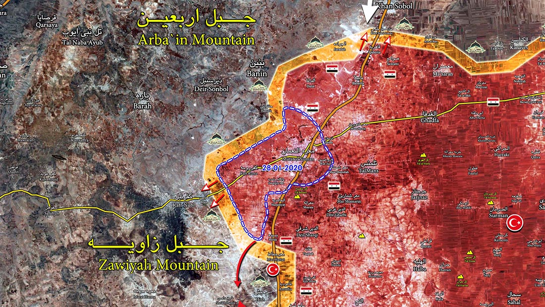
Tag: Maarat al-Numan map

  • Map: Latest Military Situation of Idlib province; strategic town of Maarat al-Numan is liberated!

    Map: Latest Military Situation of Idlib province; strategic town of Maarat al-Numan is liberated!

    It seems in the last three days, militias have evacuated the town.

    At the moment the engagement is going between Syrian Army and militants in Has area in southwest of Kafr Roma.
    In north of Maarat al-Numan axis also Syrian Army are fighting with militia in south of Kafr Nobol.
    In this axis the distance between Syrian Army forces to Saraqeb town is almost 13 km.

    Local sources reported that Turkish Army is building an observation post on the road Saraqeb and Kafr Nobol!
    Turkish observation post in Maar Hattat is almost sieged which will be sieged completely by Syrian Army soon.

    Interactive map
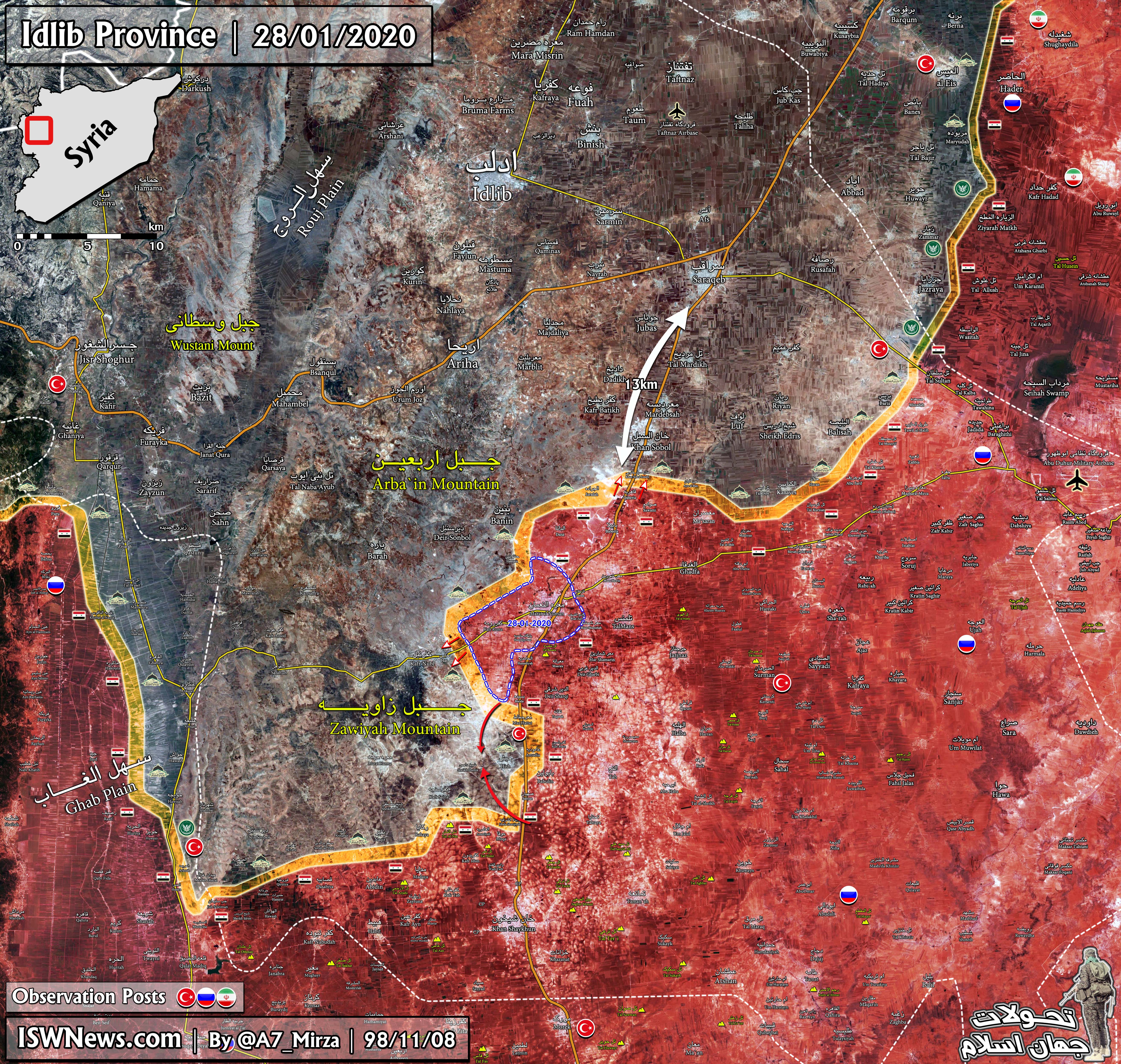
    Click to see the full size map
  • Map: Latest military situation in the Idlib province; SAA cut M5 highway north of Maarat al-Numan

    Map: Latest military situation in the Idlib province; SAA cut M5 highway north of Maarat al-Numan

    According to the Syrian Army’s advance model, it is likely that Syrian forces will seek to besiege the city of Maarat al-Numan and then enter it. In recent months, several other towns and areas in Idlib have been liberated by the same model.

    The red arrows indicate the possible axes of the advance of the Syrian Army or the creation of new pockets.

    Given the heavy and precise artillery and aerial support for the Syrian Army’s operations, the militant defensive lines are broken and virtually villages and areas are taken over one after another by the Syrian Army.

    Click to see the full size map