Friday 6 December 2019 - 16:34
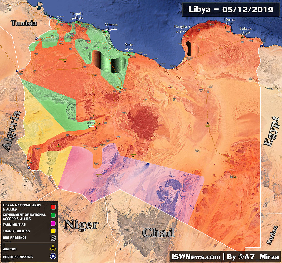
Map: Latest Military Situation in Libya, 5 December 2019
1. South of Tripoli: No flight zone over Tripoli imposed by LNA shows that Gen. Haftar has a step by step plan to conquer the capital. At the moment GNA forces are resisting hard in the south of Tripoli and made it difficult for LNA to advance. Latest updates show that LNA attacked west of […]